GRACE (GIS/T Resources and Applications for Career Education)
Project Objective: to prepare youth in economically disadvantaged communities for the prospect of careers in science, technology, engineering, or mathematics (STEM) through Geographic Information Science and Technologies (GIS/T).
Geographic Information Science (GIS) — a spatial science that allows users to create interactive searches, analyze spatial information, edit data in maps, and present results in multi-media forms — has valuable applications for fields such as engineering, planning, management, transport/logistics, telecommunications, social and natural sciences, and business. The GRACE Program is a broad partnership between local and statewide organizations to provide technical mentoring and workplace opportunities for the students participating in real-world problem solving using GIS applications.
Geographic Information Science (GIS) — a spatial science that allows users to create interactive searches, analyze spatial information, edit data in maps, and present results in multi-media forms — has valuable applications for fields such as engineering, planning, management, transport/logistics, telecommunications, social and natural sciences, and business. The GRACE Program is a broad partnership between local and statewide organizations to provide technical mentoring and workplace opportunities for the students participating in real-world problem solving using GIS applications.
Hear more about GRACE from our interview on Copper Country Today (December 3, 2017), this interview on TV6, or this article from Michigan Tech
In the Keweenaw, GRACE is a partnership between the HESAL Lab and the Institute for Geospatial Research and Education at Eastern Michigan University, CLK and Houghton Schools, the Keweenaw National Historical Park, and the Western UP Planning and Development Region.
GRACE Activities & Events
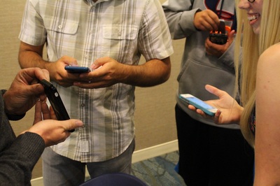
Exploring How Torch Lake Changed Over TimeInterns explored the historical environment in the modern community with GIS-enabled mobile technology; using iPads and smartphones to gain perspective on the local history and environment.
|
Mapping Quality of Copper County ParksInvestigating using GIS technologies and field data collection what makes for a good public park and where we can focus our development to improve them.
|
Analyzing Neighborhood Impacts on HealthUtilizing GIS mapping to improve human mobility in the downtown Calumet community. Interns utilized mobile GIS technologies to record their pathways and pertinent information regarding safety, densities, trees, etc.
|
Navigation: R/V Agassiz TripLearning navigation techniques and skills at MTU's Great Lakes Research Center and on aboard the Research Vessel Agassiz. Interns learned how to read maps, how to operate hand navigational tools, and locate relative position.
|
Ground Penetrating RadarDigging into history with archaeologists from Keweenaw National Historical Park and MTU to learn how to save cultural resources using non-invasive geospatial technologies.
|
Finding Geologic FaultsSearching through the Keweenaw with the Geologists from MTU and the State of Michigan to locate and map the ancient faults of our region.
|
GRACE Intern StoryMaps
GRACE Interns complete their summer internship by creating a interactive StoryMaps to communicate their research results to the community.
2018
In 2018, GRACE students completed an environmental audit for the Villages of Calumet and Laurium. The students created three webapps, one for local administrators, one for visitor's, and one for the local community. Check them out at www.calumetmap.com
2017
People in the Active Community (Yvonne Oja & Cameron See, Calumet and Houghton High)
Examining the Correlation between Cigarette Butts and People (Sam Raber, Houghton High)
What Makes Us Feel Unsafe (Will Stier, Houghton High)
Location of Mobility Needs (Leah Riutta, Calumet High)
What influences the amount of traffic in an area? (Michael Ackerman, Houghton High)
Which community is the most pleasant? (Jenna Kivela-Heinz, Calumet High)
The Potential Effects of Vacancies (Miranda Rich, Calumet High)
How Gender Impacts Environmental Perceptions (Loviisa Berg, Calumet High)
Evaluation of Local Keweenaw Parks (Nick Laemmrich, Calumet High)
Distribution of People in Calumet and Laurium (Jason Ackerman, Houghton High)
2016
Nick Laemmrich & Trevor Kangas (Calumet High)
"A Walk through Time:" Changing Environments in Calumet & Laurium
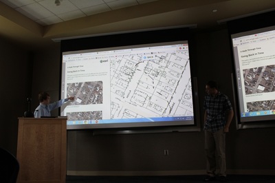
Nick and Trevor used old maps to imagine how their usual routes to and from school might have looked and felt different 75 years ago. Here’s part of their presentation available on YouTube.
Jason Ackerman & Tim Stone (Houghton High): Keweenaw Time Traveler
Jason and Tim explain what the Time Traveler is all about and highlight fun stories about change over time in our towns. Jason sums up the Keweenaw Time Traveler really nicely in this video here!
Kailyn Dominguez-Taylor (Calumet High): Project SISU- Welcome to the Beautiful Keweenaw
Kailyn built an interactive map to showcase her 2012 experience with Project SISU. Here’s Kailyn talking about her work.
Kaisa Nagel & Tyler Kipina (Calumet High): Marine Mapping and Navigation on board the RV Agassiz
Kaisa and Tyler teach us how to find our way in the landscape aboard Michigan Tech’s research ship.
Yvonne Oja (Calumet High): Keweenaw National Historical Park and Heritage Sites
Yvonne made the NPS Keweenaw Guide newspaper into an interactive StoryMap that Park visitors can carry in their digital pockets.
Garrick Ensminger & Ilhan Onder (Calumet High): Walkability in Laurium and Calumet: A Student's Perspective
Garrick and Ilhan show us where the GRACE students think are the best and worst places to cross streets in Calumet and Laurium, as part of their contribution to the Keweenaw National Historical Park's Complete Streets Project.
Here, Ilhan tells about the Complete Street program.
Jacinda Wheelock (Calumet High): Missing in the Copper Country—Calumet
Jacinda’s StoryMap highlight’s the Keweenaw National Historic Park’s popular #MissingintheCopperCountry program.
